
A soil score is more useful when you can inspect what is behind it.
A reading sequence for an ArgenFields US report:
- Check the boundary and data coverage.
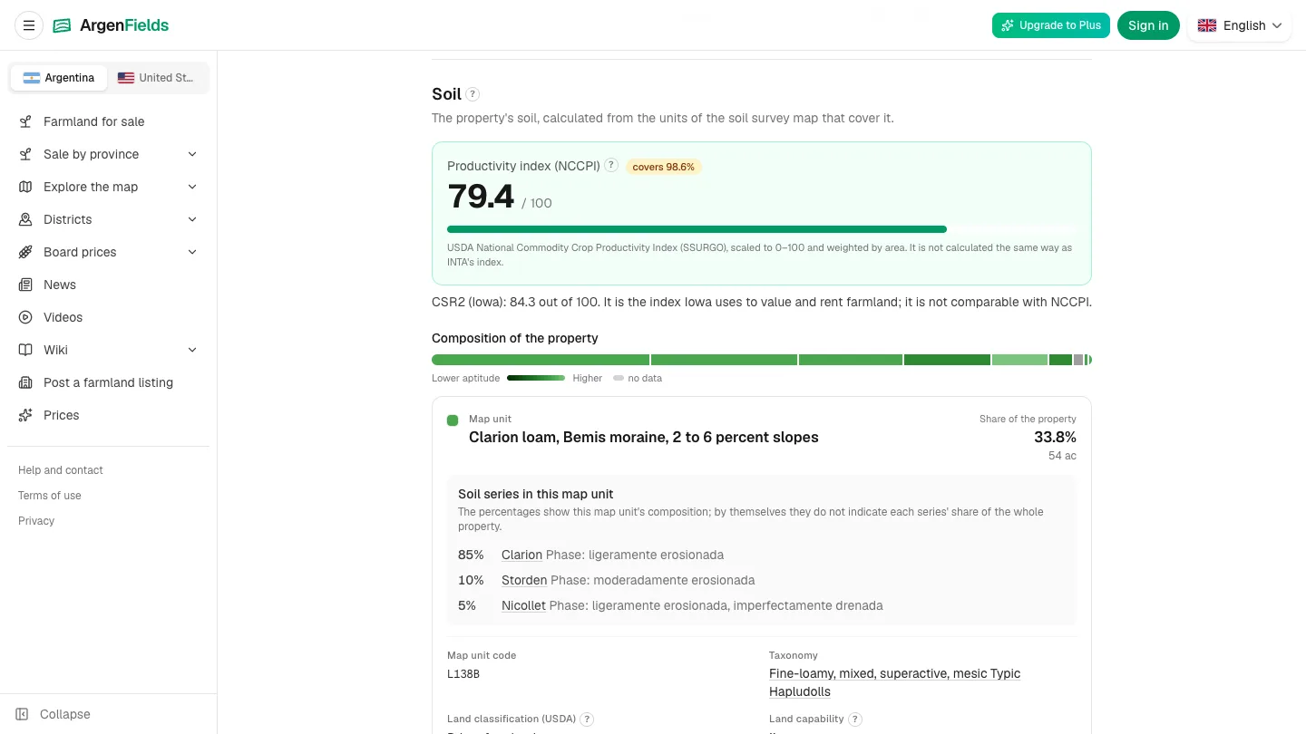
- Read soil composition alongside the score.
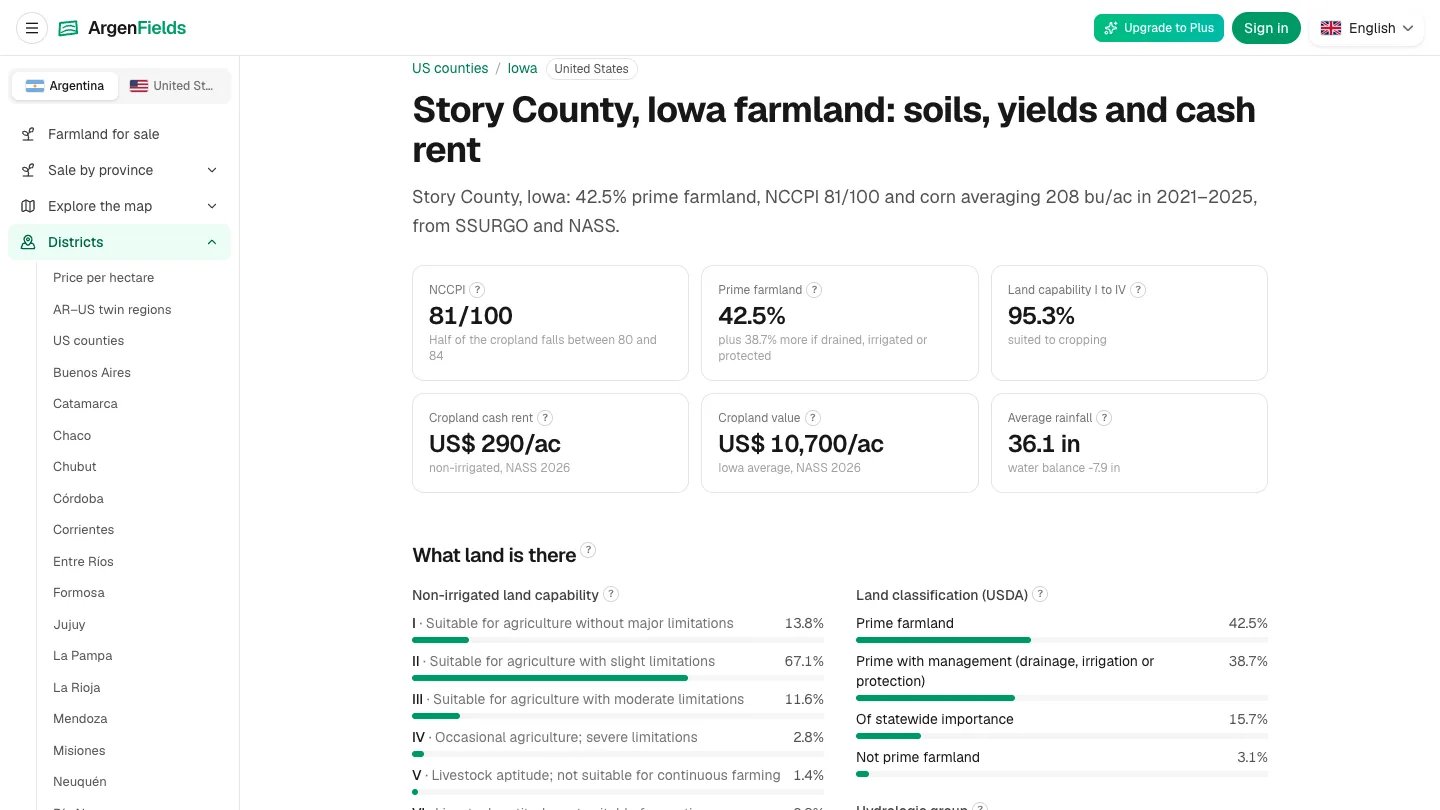
- Keep county context separate from field-level data.
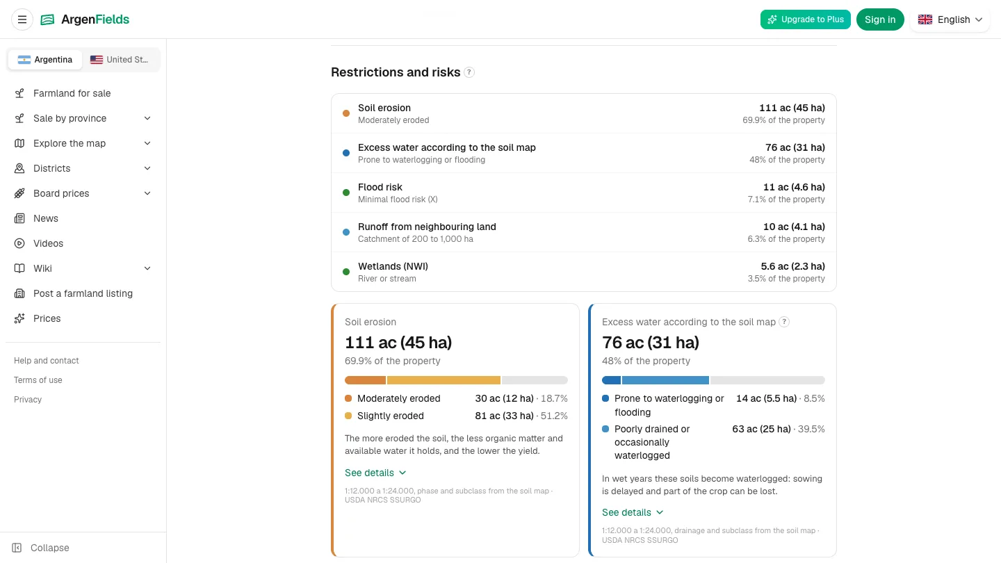
- Check sources and dates for mapped risks and regional prices.
ArgenFields maps farmland in Argentina and the contiguous US. US reports add indicative rent/land-value ranges, solar screening and dated grain prices with basis. Tero is an AI map assistant; report indicators use public datasets.
Free maps; weekly free report allowance, paid capacity. Coverage varies. Missing data does not establish absence of risk. No substitute for a site visit or appraisal.
https://www.argenfields.com/en
Real app screenshots: 5 November 2026. Posted on behalf of ArgenFields; text prepared with AI assistance and checked against product documentation.
1 impression